 Edwin Nand
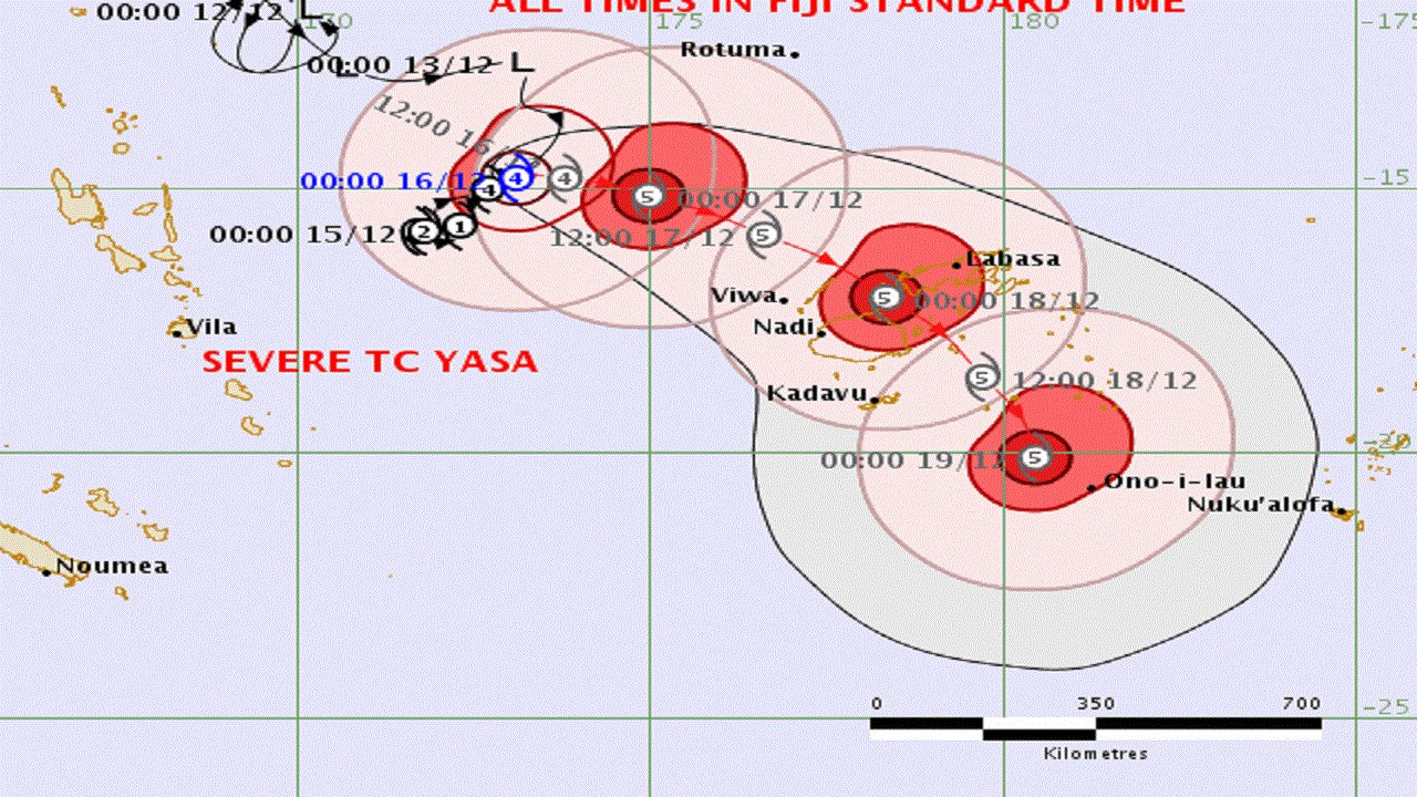
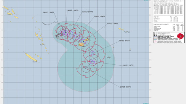
Tropical cyclone Yasa is now a category five system with sustained winds of more than 200 km/ph close to its centre.
Severe TC Yasa rapidly intensified overnight from a category four and remains slow-moving about 550 kilometres Northwest of Nadi.
The system is expected to head towards the Fiji Group later today having made a loop, and is now taking a Southeasterly track.
It is still expected to pass near the Yasawa Group before making its way between the two main islands tomorrow, and exiting Fiji via the Lau Group by Saturday.
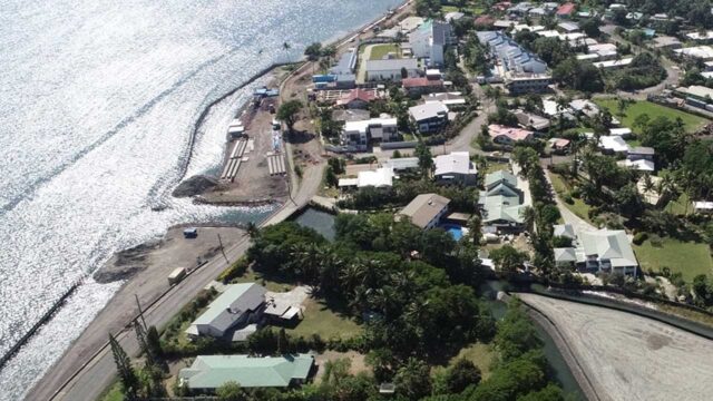
The Fiji Meteorological Service says given the size of TC Yasa, the whole of the Fiji Group will experience gale force winds of up to 87km/ph.
A tropical cyclone alert remains in force For Rotuma, Yasawa and Mamanuca group, Northern half of Viti Levu from Nadi through to Tavua, Rakiraki to Korovou, Lomaiviti group, Northern half of Vanua Levu Nabouwalu through to Votua to Labasa and through to Udu point and nearby smaller islands.
Close to its centre the cyclone is expected to have average winds up to 200 km/hr with momentary gusts to 280 km/hr.
The average winds close to its centre are expected to increase to 220 km/hr with momentary gusts to 300 km/hr by 12.00am tomorrow.
The cyclone is expected to be located about 230 kilometres Northwest of Yasawa-i-rara, about 320 kilometres northwest of Nadi at 6:00am tomorrow.
Twelve hours later, it will be 30 kilometres north of Yasawa-i-rara or about 150 kilometres north of Nadi.
Destructive winds are likely to begin several hours before the cyclone centre passes overhead or nearby.
Strong winds with average speeds upto 45 km/hr with momentary gusts upto 65 km/hr are forecast for Rotuma, Yasawa and Mamanuca group, the Northern half of Viti Levu from Nadi through to Tavua , Rakiraki to Korovou, Lomaiviti group, Northern half of Vanua Levu, Nabouwalu through to Votua to Labasa and through to Udu point and nearby smaller islands.
Winds expected to increase to damaging gale force winds with average speeds of 75km/hr from Thursday morning and to further increase to destructive storm force and very destructive hurricane force winds upto 185km/hr with momentary gusts upto 260km/hr on Thursday night.
Rain expected to become frequent and heavy with squally thunderstorms from tomorrow.
Flash flooding of low lying areas likely.
Expect phenomenal seas, damaging heavy swells and storm surges on Thursday and Friday.
Expect sea flooding of low-lying coastal areas especially during high tide.
For the rest of Fiji group: Winds expected to become strong with average speeds of 45km/hr on Thursday and expected to increase to damaging gale force winds with average speeds of 75 km/hr and even further increase to destructive storm force and hurricane-force winds upto 220 km/hr and momentary gusts upto 300 km/hr on Friday.
Risk of flash floods of low lying areas. Very rough to high seas. Damaging heavy swells and storm surges likely.
Flooding including sea flooding of low-lying coastal areas expected on Friday.
A flash flood warning remains in force for the low lying areas and areas adjacent to small streams and Dreketilailai river to Qawa station.
A flood alert remains in force for the low lying areas and areas adjacent to small streams for the interior of the main island; low lying areas and areas adjacent to small streams along Galoa to Navua and Navua to Lobau in the Central Division; upper Nadarivatu, Monasavu, upper Wainimala, upper Sigatoka and upper Nadi catchment.