 Mollyn Nakabea
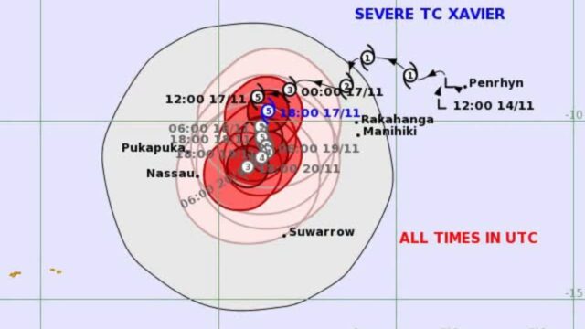
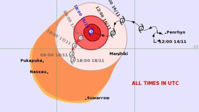
[Photo: Supplied/Fiji Met Services]
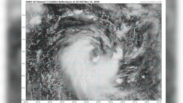
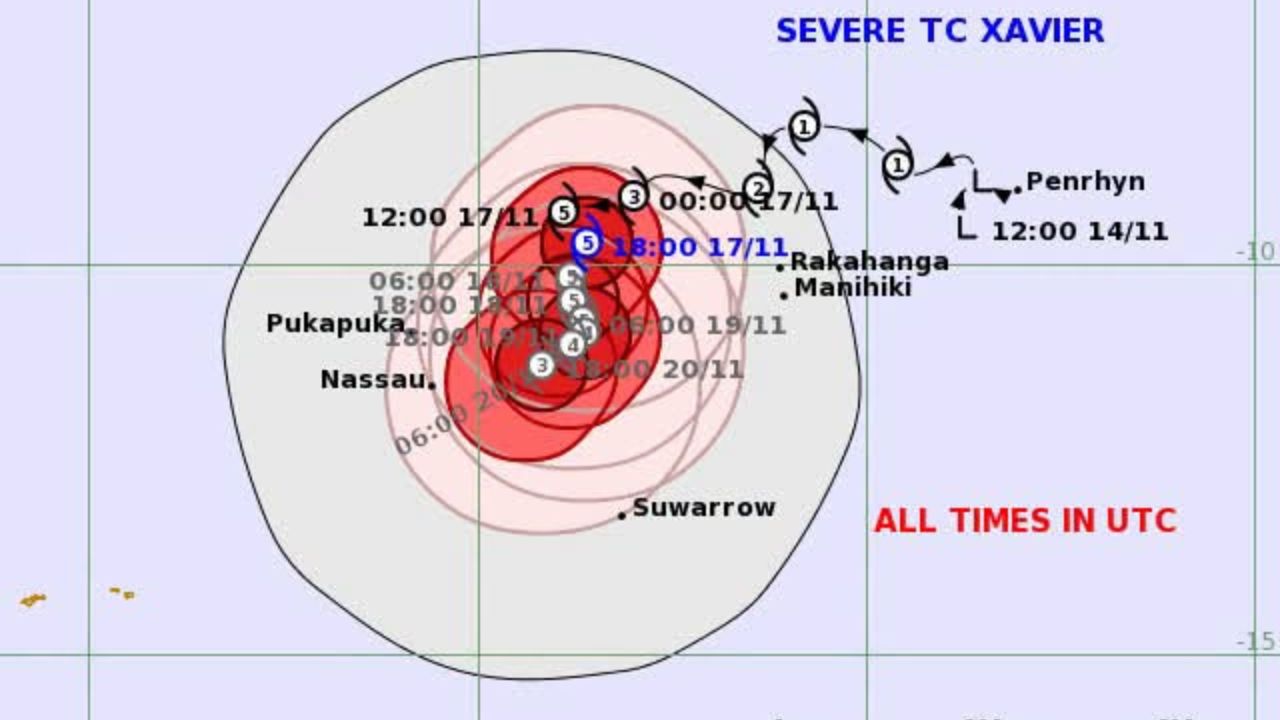
Severe Tropical Cyclone Xavier has intensified into a Category 5 system – the highest level on the tropical cyclone intensity scale.
It is the first Category 5 cyclone monitored by RSMC Nadi since Tropical Cyclone Lola in 2023.
After rapidly intensifying over the past 24 hours, Xavier is packing maximum sustained winds of 215 to 220 kilometres per hour, with even stronger gusts near its centre.
The cyclone is forecast to maintain its intense strength as it moves west-southwest to southwest across the Northern Cook Islands region, before gradually weakening.
Hazardous weather conditions continue to affect parts of the Northern Cook Islands.
A Gale Warning remains in force for Pukapuka and Nassau, while a Gale Alert is in place for Suwarrow. A Strong Wind Warning also remains in force for Manihiki and Rakahanga.
In areas under the Gale Warning and Alert, average winds could reach 85 kilometres per hour, with momentary gusts of up to 120 kilometres per hour.
Heavy rainfall, squally thunderstorms, high seas, and damaging swells are also expected, alongside a risk of coastal inundation during high tides.
While the current forecast track does not show the cyclone’s centre making landfall over the affected islands, damaging winds, heavy rain, rough seas, and coastal impacts can still occur well away from the centre.
As RSMC Nadi, the Fiji Meteorological Service continues to monitor Xavier’s movement and intensity.
The public, especially those in the affected islands, are urged to stay alert and follow the latest official updates from their National Meteorological Services.