 Edwin Nand
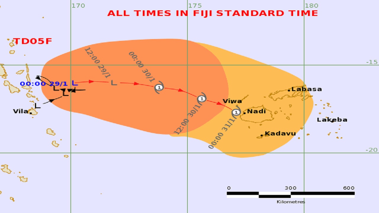
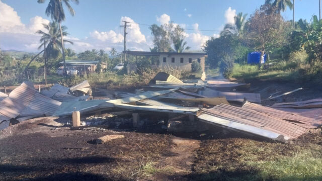
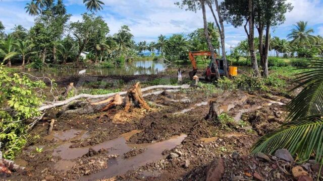
A flood warning remains in force for low lying areas and small streams next to Qawa river in Vanua Levu.
Areas that are already affected are Dreketilailai, Boubale and Urata crossings; Nakauvadra River from Vatukacevaceva to Rakiraki town.
Areas that will be affected are Naqoro Flat and Qalau Flat from WAF pump sites, low lying areas along FSC road, low lying areas for Tavua at Nasivi, low lying areas along Ba FSC, low lying areas and areas adjacent to Navala river and Toge river, low lying areas and small streams for Keiyasi river downstream to Sigatoka town, low lying areas and areas adjacent to Nadi bridge.
A flash flood warning remains in force for all low lying areas and small streams near to major rivers in Vanua Levu and Viti Levu, Labasa river, Qawa river – Vunivau stretch toward Vuniika flat, Soasoa flat, upper Labasa river at Korotari flat; most of the crossing within the areas mentioned in Labasa have been affected already.
Areas included in the flash flood warning are Nabouwalu to Labasa, Nabouwalu to Kubulau, Dawara to Nabalebale village along the Wailevu West coast road, Naibalebale village to Savusavu, Savusavu to Natewa and Tunuloa, Koroalau to Saqani and Saqani to Labasa.
Areas included in the flash flood warning for Viti Levu are Tuva river, upper Nadi catchment, from Lautoka to Korovou, the upper catchment of Wainimala and Wainibuka river, Lomolomo stretch to Sabeto flat, Nadi backroad to Moala flat.
Water level at Nasivi station in Tavua was 2.75m at 5.00 am which is above alert level and increasing.
The Ba FSC station was at 6.04m and increasing along with the Toge station Keiyasi station and the Nadi bridge.
A tropical cyclone alert remains in force for the Fiji group Tropical Depression 05F was located just East of Vanuatu or about 780km West-Northwest of Nadi at 3 am today.
Expect winds of up to 65km/Hr gusting to 90km/hr within the next 24 to 48 hours. The system is slow-moving and is expected to track East then Southeast towards Fiji.
TD05f has a very high chance of developing into a tropical cyclone in the next 24 to 48 hours.